Anderson Glacier is the headwaters of the Quinault River in the Olympic Mountains of Washington. A century ago the glacier was 2 km long, and a half kilometer wide. Retreat of this glacier in the first half of the 20th century exposed a new alpine lake, as the glacier retreated 1 kilometer. From 1950-1980 the glacier diminished slowly. From 1959 to 1990 the glacier thinned and retreated from the lake trapped behind the Little Ice Age moraine. The picture below was given to me by Austin Post.  Since 1990 the glacier has begun to shrink rapidly. The USGS aerial photograph of the glacier is from 1990, Anderson Glacier is on the right, West Glacier is to the left.
  Investigating this glacier in 1992 we measured its area at 0.38 square kilometers, down from 1.15 square kilometers a century before. Ten years later the glacier had diminished to 0.30 square kilometers, but had thinned even more, leaving it poised for a spectacular change, over the next five years. Large outcrops of rock have appeared beginning in 2003 and further exposed in 2005 and 2009 in the middle of the glacier. Note the outcrops in this 2007 image from Kathy Chrestensen
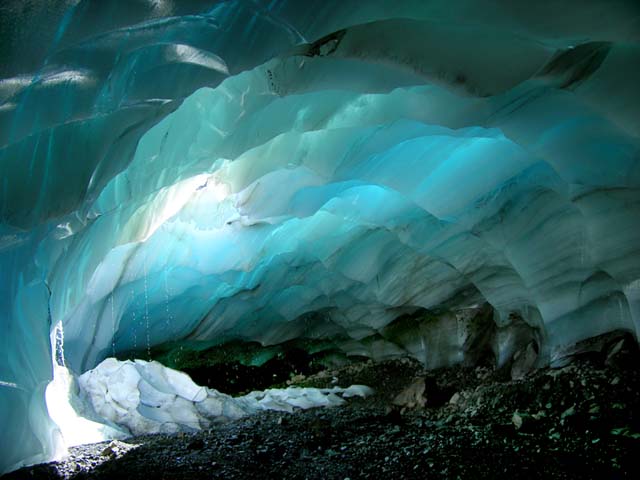
  The end of the glacier is an avalanche runout area and is thinning slower than most of the lower reach of the glacier. This glacier has become a series of small disconnected relict glacier ice patches. There are some large ice caves that have developed under the glacier. This is an indication of limited flow, and stagnant melting ice.
  Anderson Glacier is not the only glacier feeding the Quinault River, all the others are retreating as well. The result of glacier retreat is reduced late summer and early fall streamflow, impacting salmon runs at that time of the year. This is primarily the fall Coho, Chum and Chinook salmon and Steelhead summer run. During the spring and early summer runoff increases as snowmelt still occurs, but is not retained in the glacier system.
