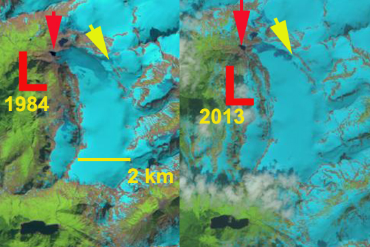
 Above is a paired Landsat image with 1984 left and 2013 right, indicating a 300 m retreat in this interval.
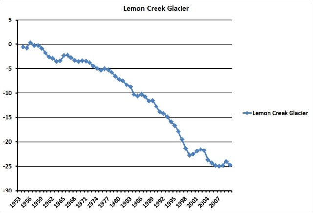
Annual balance measurements on the Lemon Creek Glacier, Alaska conducted by the Juneau Icefield Research Program from 1953 to 2013 provide a continuous 61 year record. This is one of the nine American glaciers selected in a global monitoring network during the IGY, 1957-58 and one of only two were measurements have continued.  These show cumulative ice losses of –13.9 m (12.7 m we) from 1957-1989, of –19.0 m (-17.1 m we) from 1957-1995 and –24.4 m (–22.0 m we) from 1957-1998. The mean annual balance of the 61 year record is -0.43 m/a and a loss of at least 30 m of ice thickness for the full 61 year period from 1953-2013. In the second graph the similarity with other North American glaciers is evident (Pelto et al, 2013).

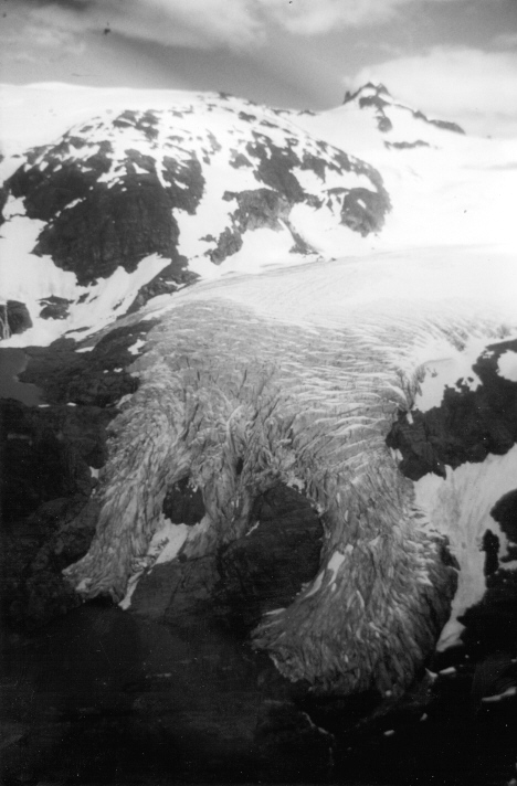
This negative mass balance has fueled a terminal retreat of 800 m during the 1953-1998 period, and an additional 200 meters of retreat by 2013.  Below is a picture of the terminus enroute to Camp 17 in 1982, and below that from 2005.
 The annual balance trend indicates that despite a higher mean elevation and a higher elevation terminus, from thinning and retreat, mean annual balance has been strongly negative since 1977 (-0.60 meters per year). Dramatically negative mass balances have occurred since the 1990’s, with 1996, 1997 and 2003 being the only years with no retained accumulation since field observations began in 1948.
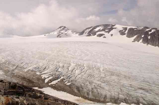
These data have been acquired primarily by employing consistent field methods, conducted on similar annual dates and calculated using a consistent methodology. The research is conducted from Camp 17 on a ridge above the glacier. This is a wet and windy place with three out of four summer days featuring mostly wet, windy and cool conditions in the summer. The camp was initially built for the IGY in 1957, and Maynard Miller and Robert Asher saw to its continued improvements through the 1980’s.  The mass balance record have been were until 1998 precise, but of uncertain accuracy. Then two independent verifications indicated the accuracy (Miller and Pelto, 1999). Comparison of geodetic surface maps of the glacier from 1957 and 1989 allowed determination of glacier surface elevation changes. Airborne surface profiling in 1995, and comparative GPS leveling transects in 1996-1998 further update surface elevation changes resulting from cumulative mass balance changes. Glacier mean thickness changes from 1957-1989, 1957-1995 and 1957-1998 were -13.2 m, -16.4 m, and –21.7 m respectively. It is of interest that the geodetic interpretations agree fairly well with the trend of sequential balances from ground level stratigraphic measurements. The snowline of the glacier lies a short distance above a tributary glacier from the north that has separated from the main glacier since 1982. The snowline on the glacier was just below this juncture in the 1950’s and 1960’s but now has typically been above this former juncture. The two images below are looking down and upglacier from this former tributary in 2005.

At the head of the glacier is a supraglacial Lake Linda, which now drains under the ice. Robert Asher in the late 1970’s and 1980’s mapped this lake system when it drained under the head of the glacier not down under the terminus of the glacier.

Pingback: Solar Minimum 2009, Global Cooling and the Record Breaking Winter - Page 157
The most record breaking aspect of the snow season was the rapidity of the snowmelt which set a record for the last 44 years across North America and the Northern Hemisphere.