
Tracy Gletscher in Northwest Greenland has experienced an accelerated retreat since 2000. Here we utilize Landsat imagery from 1987-2013 to examine this retreat. Rignot et al (2001) identified the centerline velocity as it entered the final fjord reach, 25-30km from the terminus, of 500 m/year, with a thickness of 1200 meters.
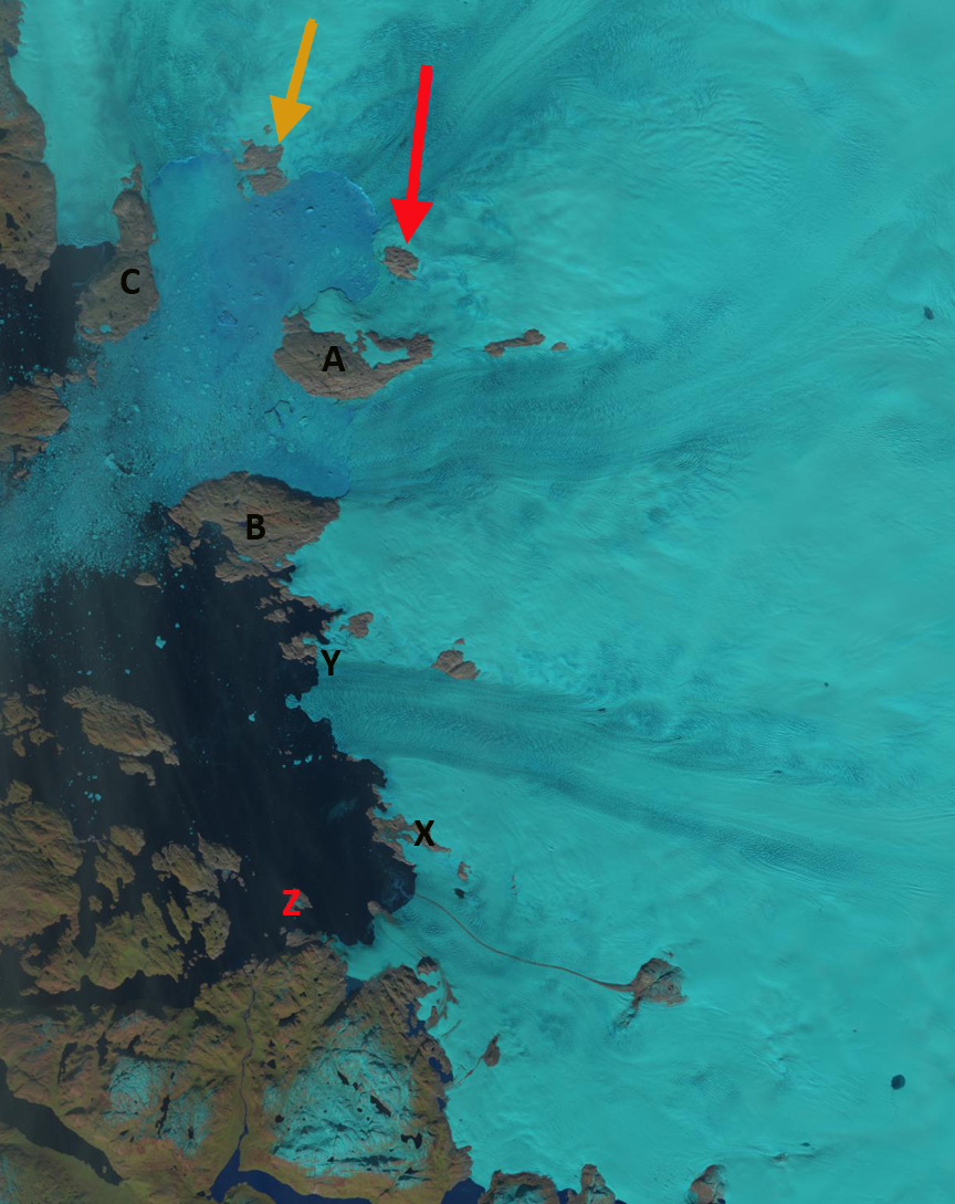
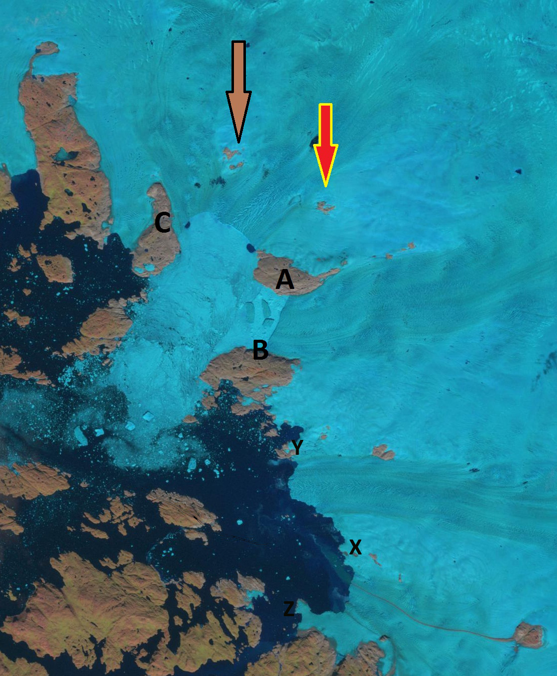
Sakakibara (2011) noted an increased retreat of 3.1 km from 2000-2011. The noted an acceleration of the glacier from 1988 to 2011 with velocities of 2 km per year 10 km behind the calving front. The 1991 geologic map of the area from GEUS indicates the tributary from the north, Farquhar Glacier, joined with the Tracy Gletscher at the terminus. 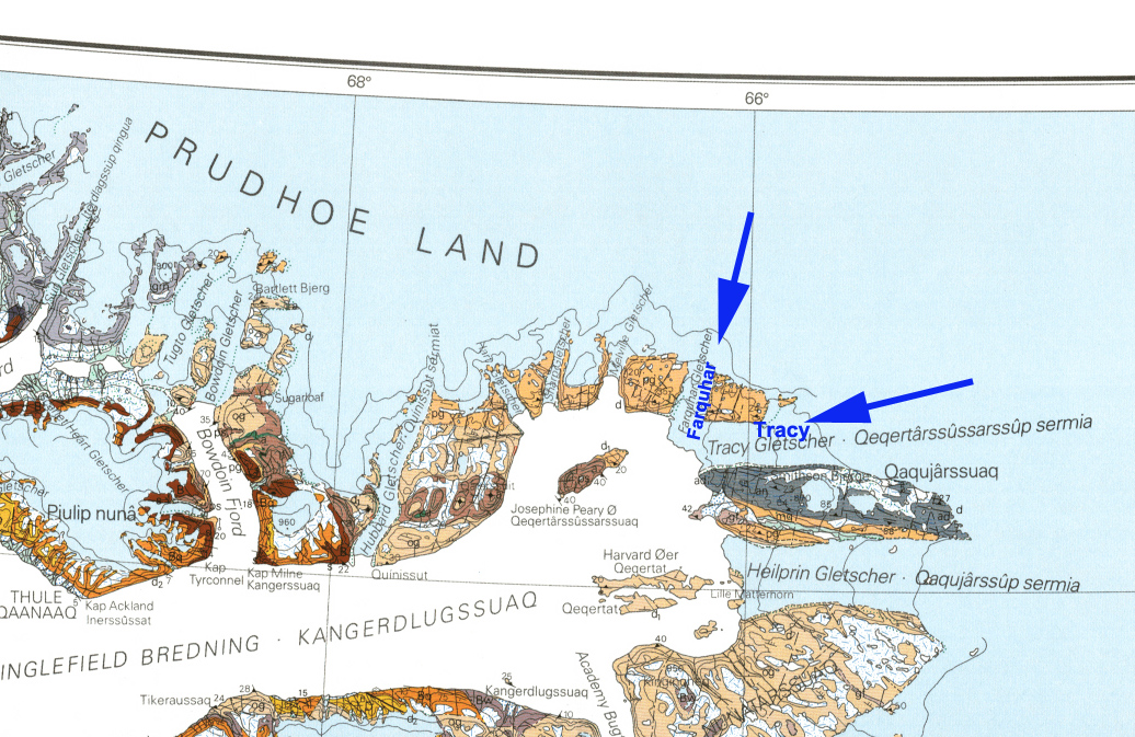 In the Landsat images the ice front of both of these glacier is indicated by red dots. The 2013 terminus location of Tracy Gletscher is indicated by a pink arrow and the yellow arrow indicates the tip of a peninsula where the southern margin of Tracy Gletscher was in 1988. There is a quite a number of large icebergs beyond the terminus in 1987, 1991 and 2000. The termini are still joined in 2000. By 2009 the glaciers are separated and have retreated into their respective fjords. By 2013 the main Tracy terminus is aligned with a kink in the lateral moraine, pink arrow. The retreat since 1987 of the main terminus has been 3 km on the southern margin, 5.5 km on the northern margin and 9 km for the center tongue. With most all of the retreat occurring since 2000. This higher retreat rate for the 1992-2000 period as the tongue collapsed is noted by Moon and Joughin (2008). The retreat is similar to that of nearby Dodge and Storm Glacier, and Kong Oscar Glacier. This glacier falls into a long list of retreating glaciers of all types in all regions of Greenland.
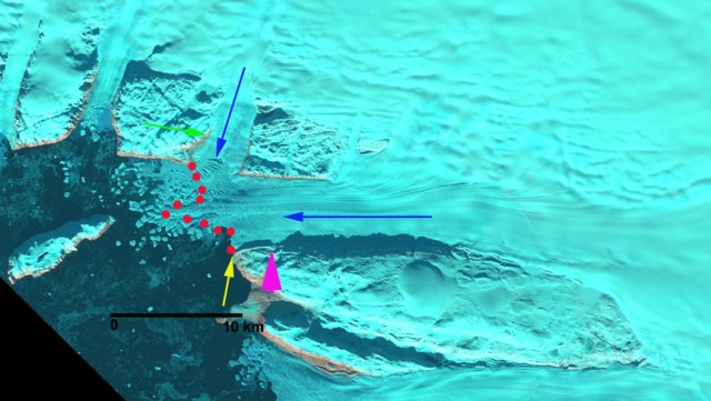


