
Theodulgletscher is one of the most visited glaciers in the world. It is part of the Zermatt ski resort in Switzerland. With three lifts crossing the glaciers western half. 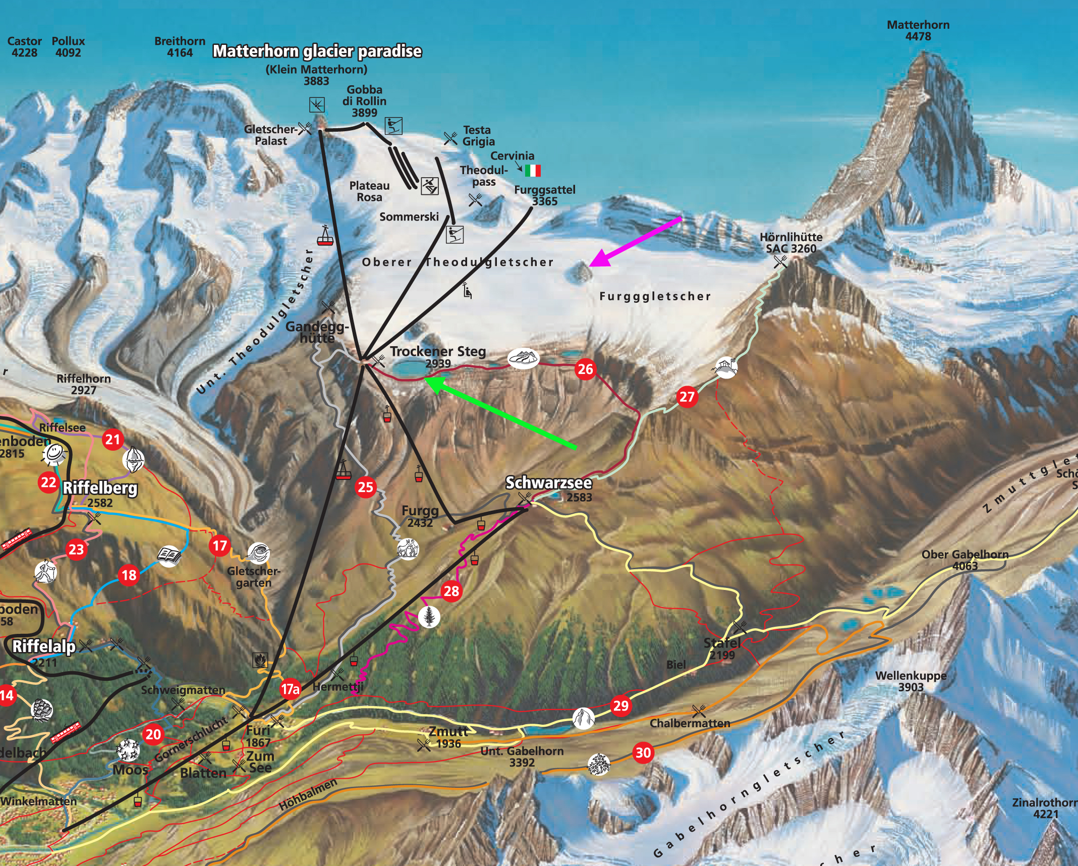 .
.
As ski season approaches I am reminded of ski area taking extraordinary steps to maintain the glaciers Stubai, Les 2 Alpes, Tignes and now Zermatt. Since 2003 summer skiing has been enhanced with Europe’s longest glacier chairlift, the 2.5 km long lift can transport 2,400 people every hour, ascending from Trockener Steg, at 2940 m, to Furggsattel station at 3365 m, above the Theodulgletscher in 8 1/2 minutes. Engineering wise the interesting part is that 12 of its 18 supporting masts stand on glacier ice, and have been engineered so that masts can shift and revolve to accommodate the glacier’s movement. This post examines changes in this glacier from 1999-2013. What makes Theodulgletscher a good ski run is its modest slope and limited movement that leads to few crevasses. The skiis runs themselves are well-groomed and marked to keeps skiers from venturing into areas where there are crevasses. With glacier retreat the distance from the glacier runs to the lift base at Trockener Steg has increased. Today an IDE snowmaker is being used to connect the Theodulgletscher to Trockener Steg with a 700 m long strip of snow. The IDE snowmaker is the world’s first snow machine that operates independently of ambient temperature. This is not enough to slow the retreat of this large glacier as seen from 1981-2011 below. The 1981 image is from Dave Brown Photrography.
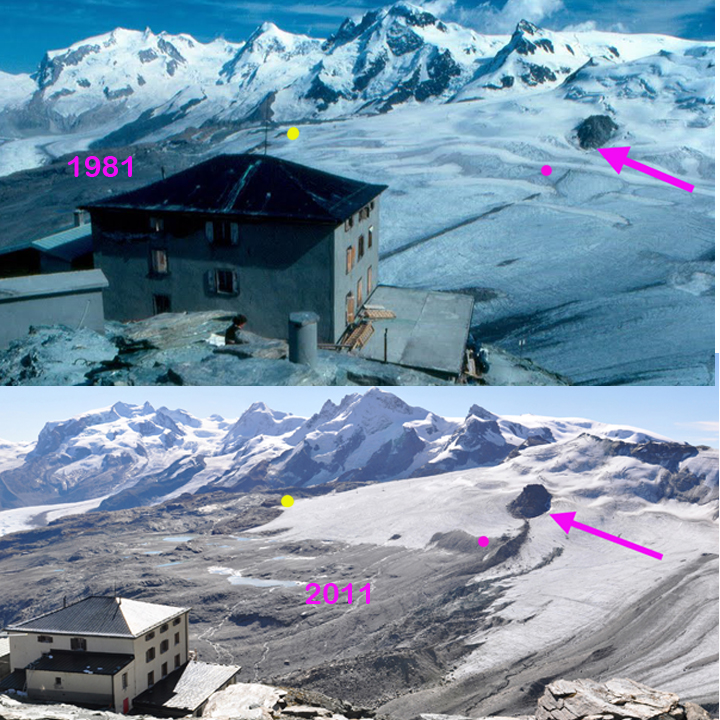
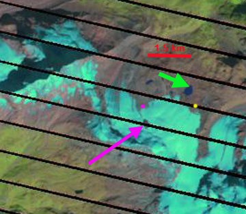
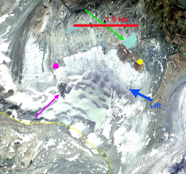
In each of the images in the sequence below and the images above the pink arrow indicates a prominent rock knob in the midst of the glacier, the pink dot below this knob is the glacier terminus, the green arrow indicates a small reservoir, and the yellow dot a location adjacent to the 1999 terminus below a rock knob. It is quite evident that the distance from the rock knob to the terminus, pink dot has changed dramatically in the 13 years 1999-2012, from 850 m to 450 m. A 400 m retreat of the west side of the Theodulgletscher in 13 years. The eastern side near Trockener Steg has experienced less retreat, with 140 m of retreat near the yellow dot. This is partly due to the grooming of the ski runs, where the compacted snow does not melt off as fast, last image. The glacier is quite thin across the entire front indicating retreat will continue.The daily web cam pictures from the top of the Matterhorn Glacier Paradise show the Theodulgletscher, though not that clearly. This identifies the day when the lower glacier loses its snowcover. This was July 19th in 2012 and August 2nd in 2013.

1999 Landsat Image
2012 Landsat Image
2009 Google Earth image


2009 Google Earth image after a snowfall.
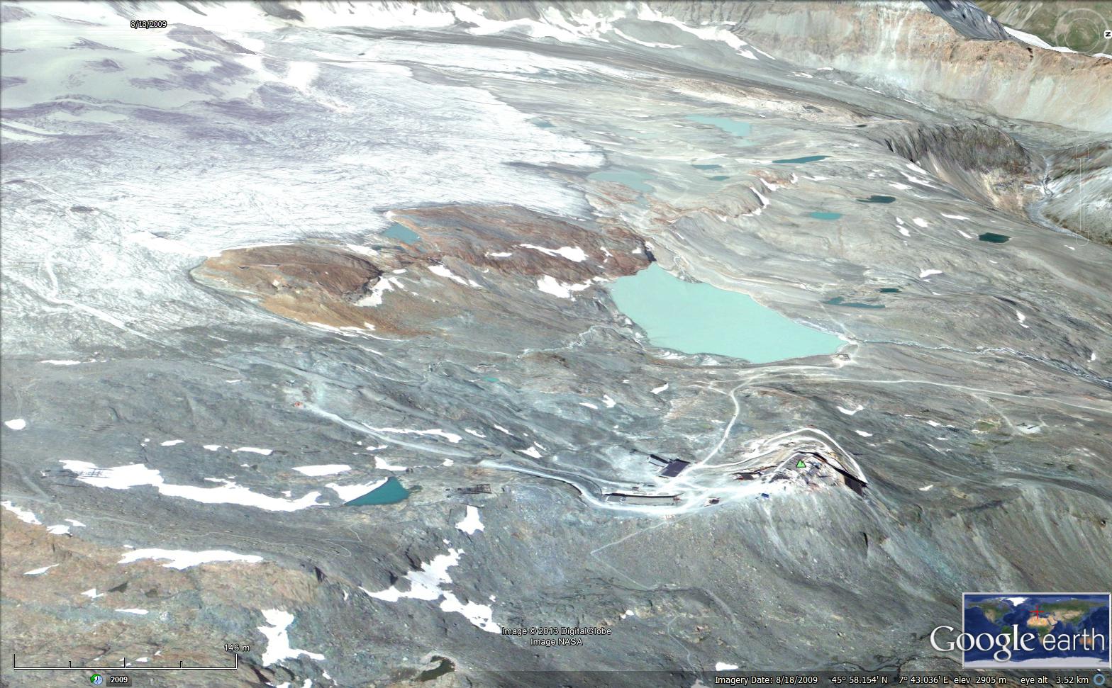
2009 Google earth side view.

2012 surface of Theodulgletscher, note the last snowcovered areas are groomed regions.
